2022 Storm Chase #1 Summary

In 2022, I led two summer storm chase trips for SIUE. One was a part of the GEOG 429 Storm Chasing and Field Assessment course and the other was through our National Science Foundation (NSF) GEOPAths grant (Award #1911512). This is a summary of the GEOG 429 trip from May 23-27, 2022. Since the trip was planned for just a total of 5 days and the first and last days are usually travel days, this really gave us three possible chase days. The weather was not particularly cooperative for these three days. I am going to omit some of the meteorological background, but the week was dominated by an upper-level trough and associated cold front that dug southward across the southern Plains. The upper-level low eventually cut off over Kansas on May 25 before slowly moving eastward over the next few days. The upper-level low and cold front pushed the moisture and instability needed for thunderstorms out of the southern Plains and into areas that are less favorable for chasing due to trees (the deep south, and eventually into the Carolinas).

May 23: We departed Edwardsville and headed southwest along I-44 with the intent that this would be a travel day but with the possibility of some chasing if we could make it far enough to get into the Marginal Risk area in central Oklahoma. We hit very cold and relentless rain as we entered Oklahoma. It very quickly became clear that any severe weather was going to be much further west. A series of several tornadoes did occur near Morton, TX, but there was no way we could reach them. We arrived at our hotel in Lawton, OK and planned for the next day.

Above: Day 1 Outlook from 1630z for May 23, 2022.

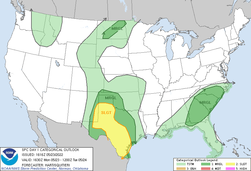
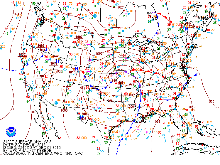
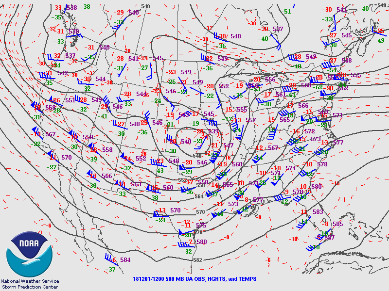
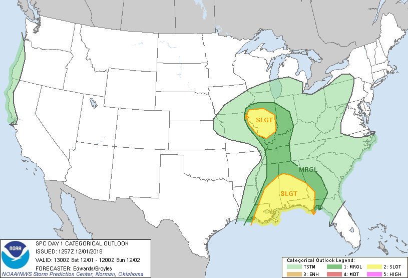
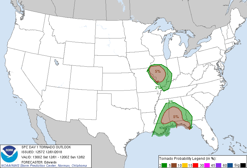
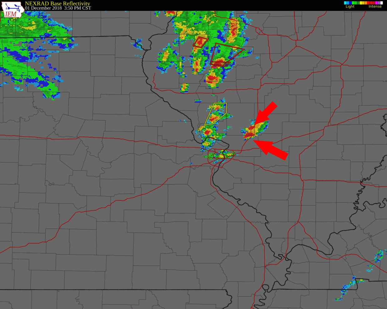
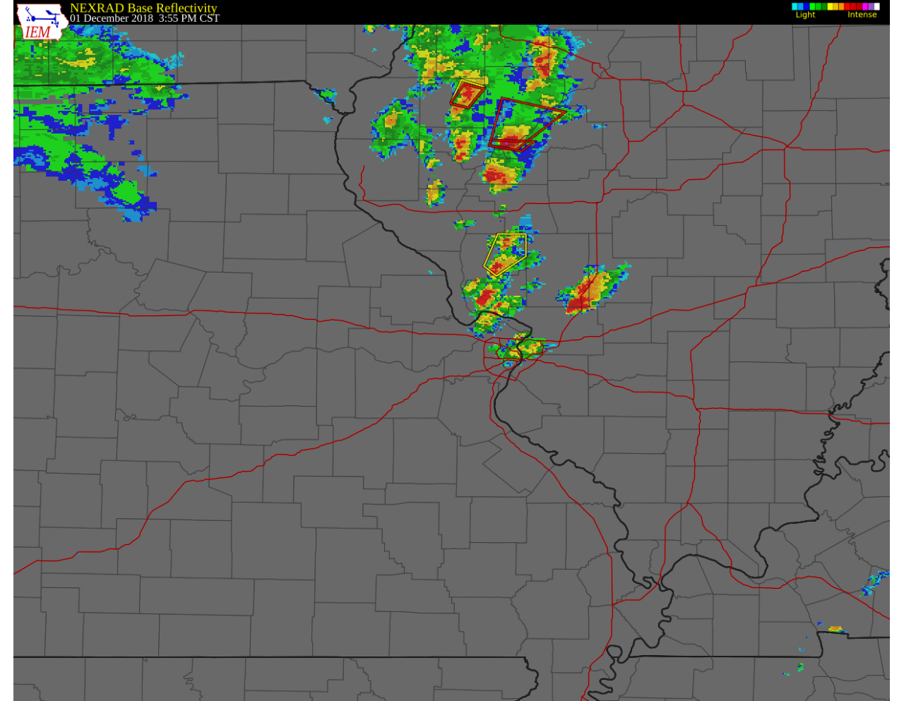
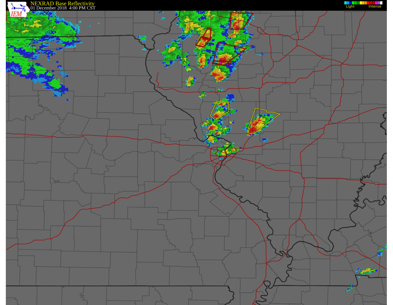
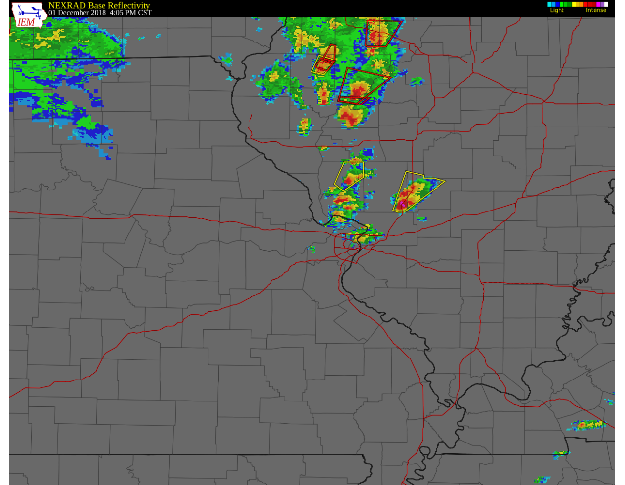
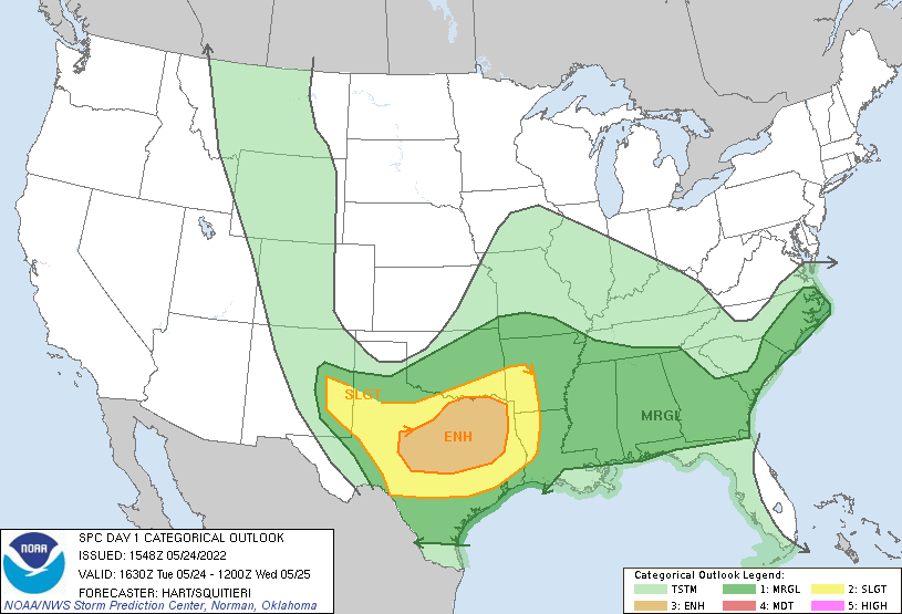
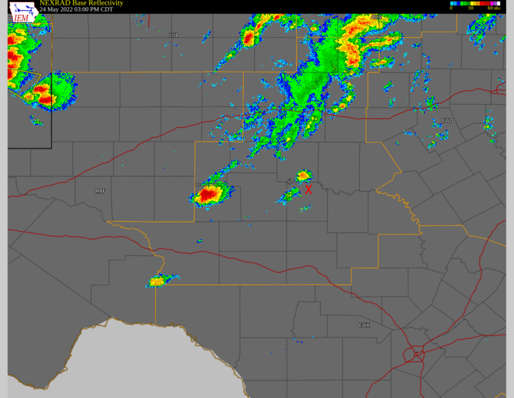
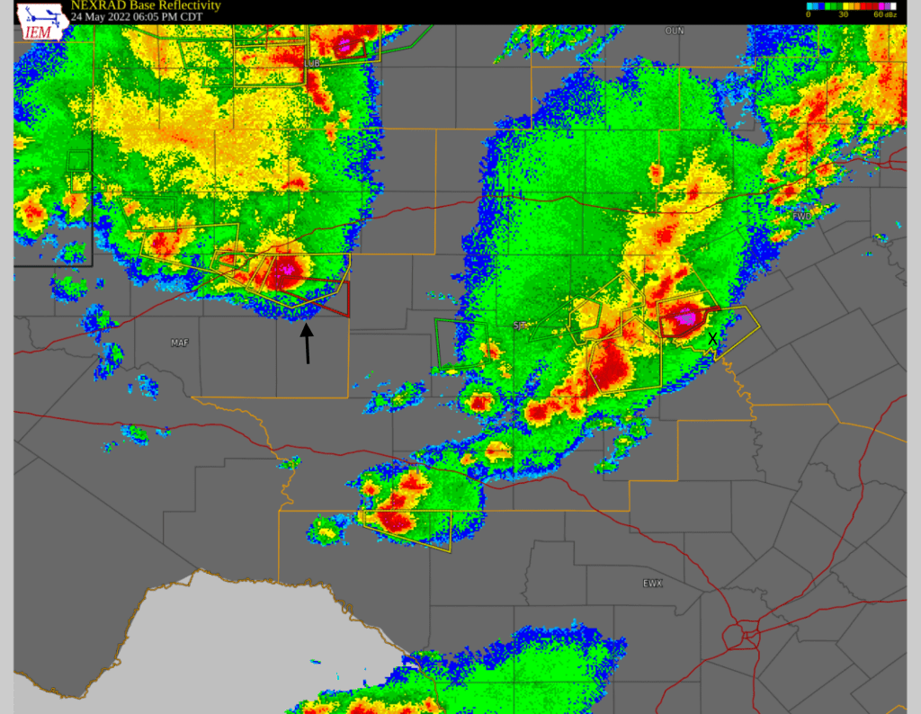
May 24: It was clear that May 24 was our best (and only) chance to intercept severe weather on this trip. Several shortwaves were moving through the previously mentioned upper-level trough across Texas, but with a “very complex convective scenario” per the 1300 UTC SPC Day 1 outlook. Essentially two areas within the broad slight risk were possible targets. The first target was a more “southern” target to the Edwards Plateau, while the other was a bit further west where storms were expected to initiate over eastern NM and track southeast. In either case, it seemed like there would be a very small window to see supercells before they consolidated into a larger thunderstorm complex (MCS). The storms were also working with a lot of moisture and were expected to be “high-precipitation” supercells with a lot of rain that would obstruct our view. From our starting position in Lawton, the southern target of roughly San Angelo, TX was a bit closer. We also felt better about targeting that area due to the interactions between the outflow boundary from morning storms and the dryline as mentioned in the 1630z convective outlook which upgraded the area to an “Enhanced” risk.

Above: Day 1 outlook from 1630z for May 24, 2022.

We drove south through intermittent rain with a target of San Angelo, stopping in Abilene for lunch and to examine data for around 1pm. By around 2:30 p.m., a severe thunderstorm watch was issued, with storms starting to fire southwest of San Angelo as we approached Ballinger, TX. Rather than continue southwest towards San Angelo on US-67, we decided to head almost directly south on US-83 from Ballinger towards Eden, hoping to stay ahead of the storm that was firing. We dropped south to Paint Rock, while a storm was starting to fire just to our north.

Above: Radar image around 3:00 p.m. Red X denotes our approximate location.

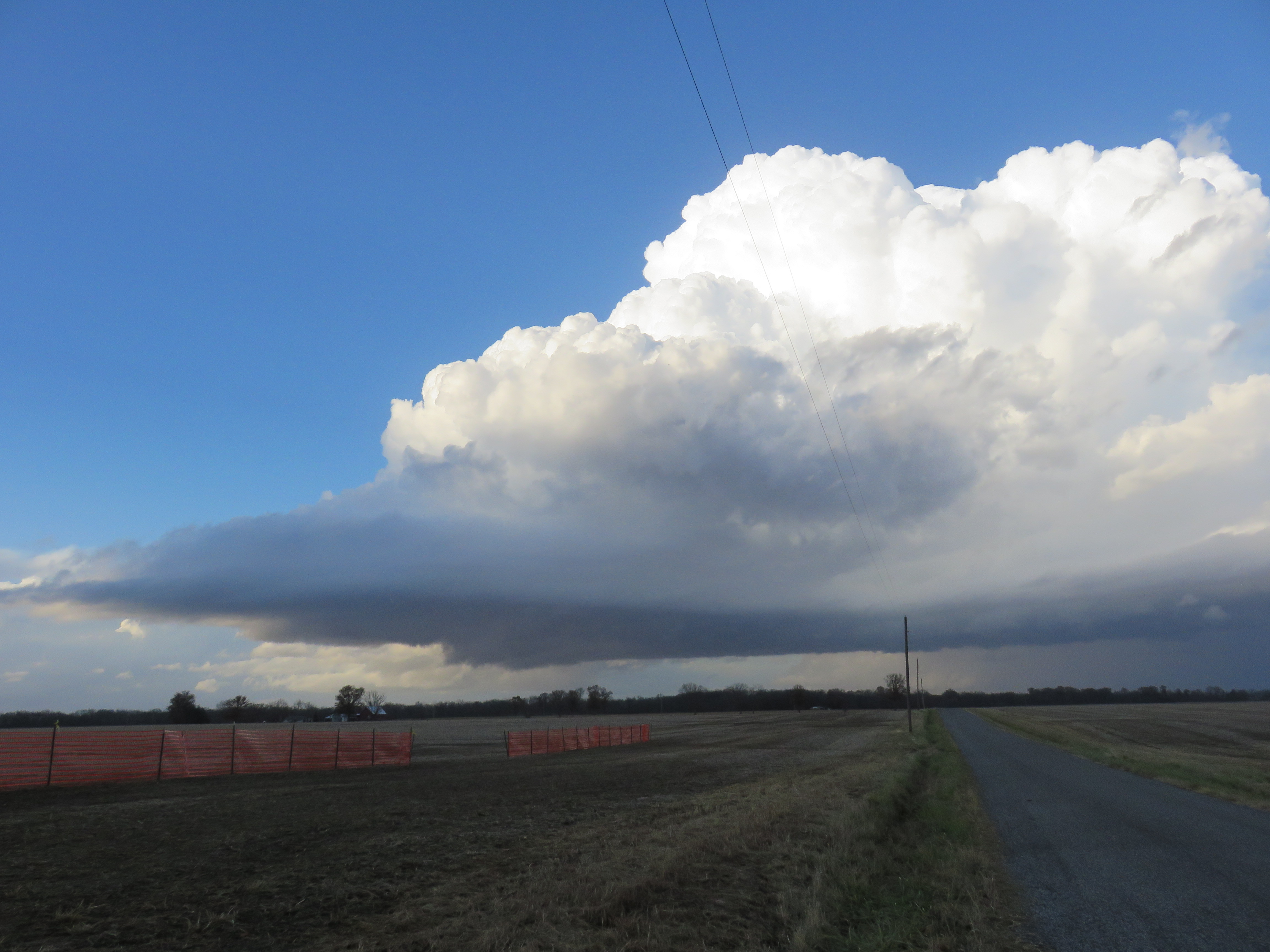
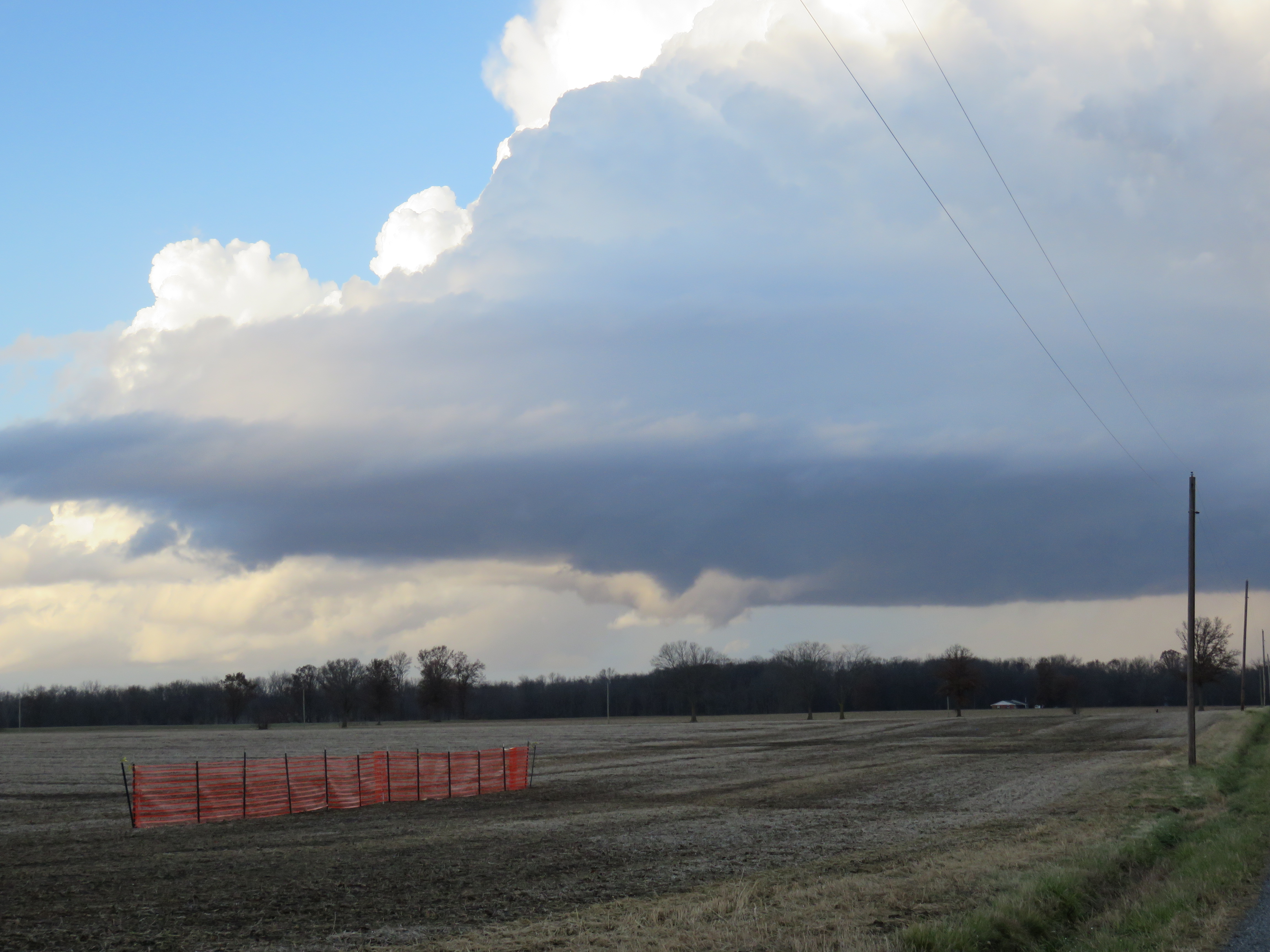
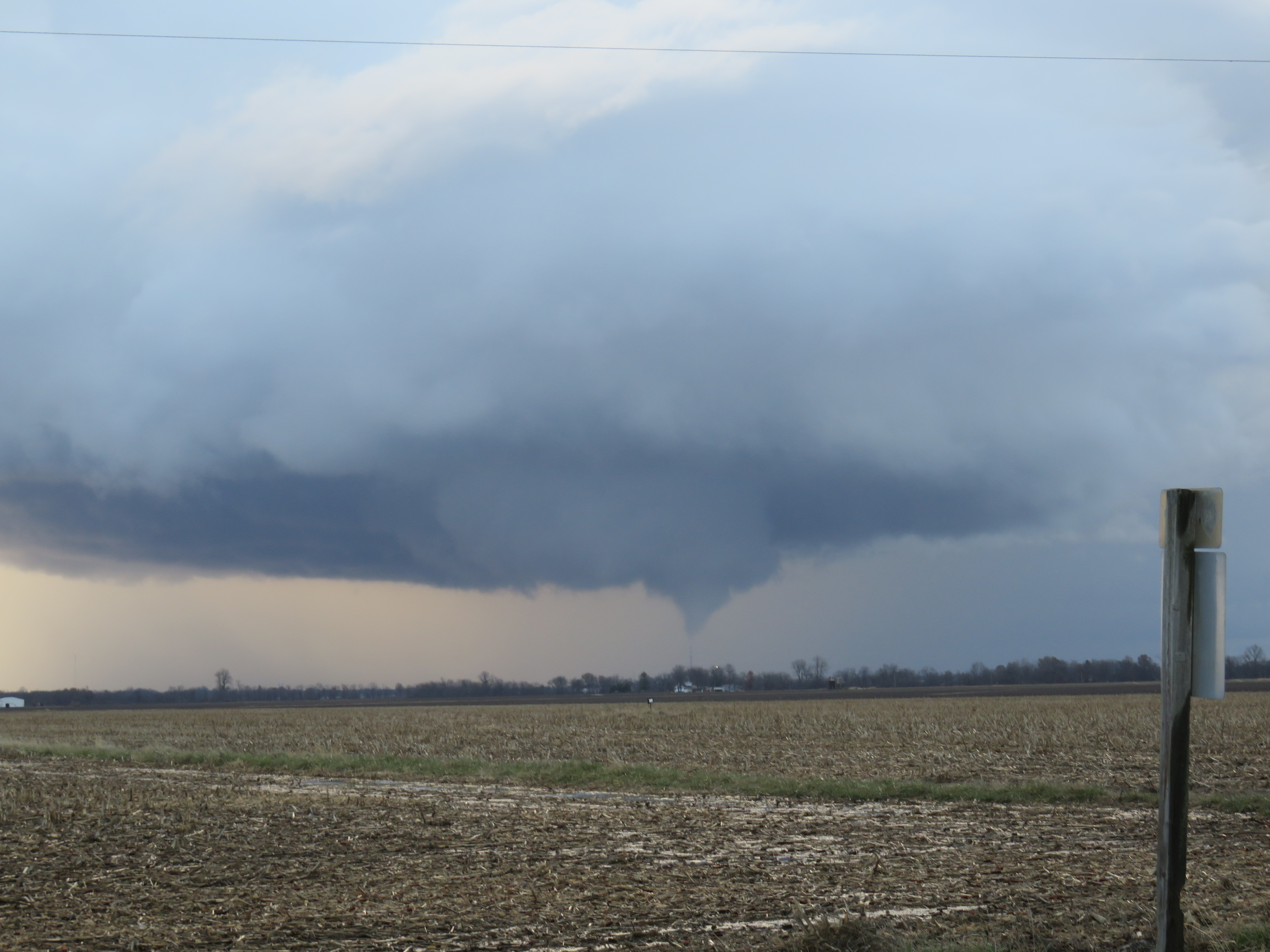
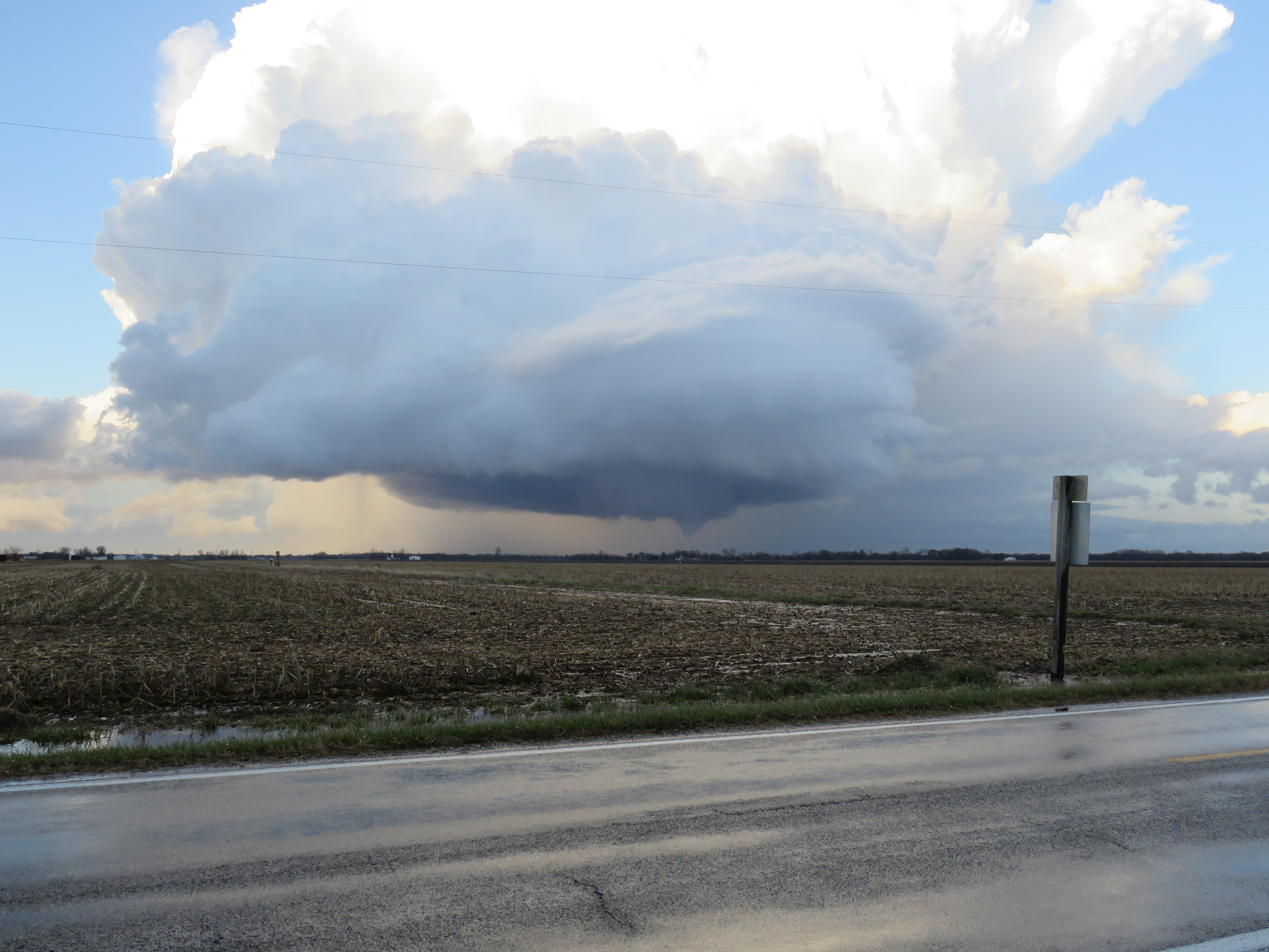
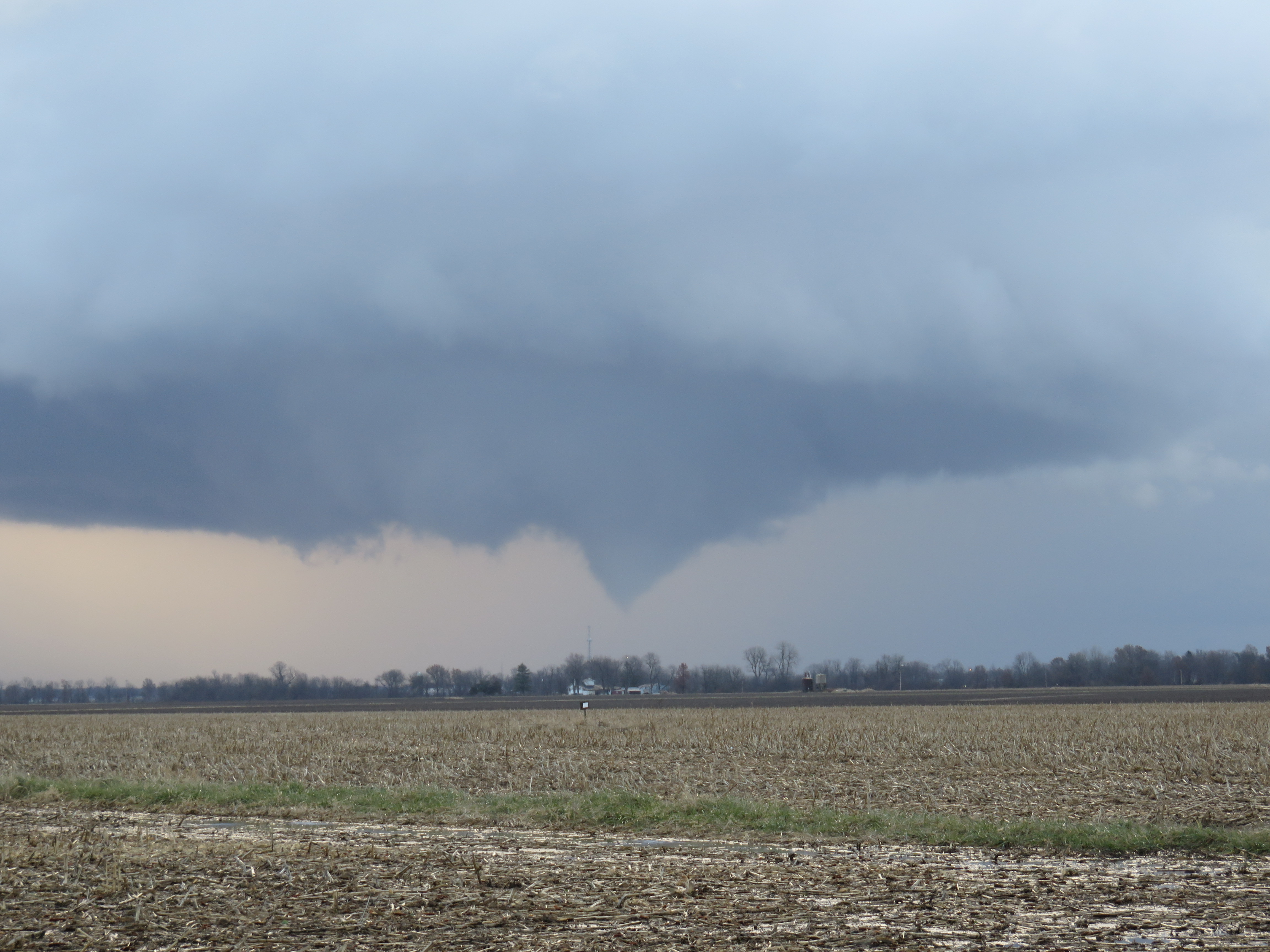
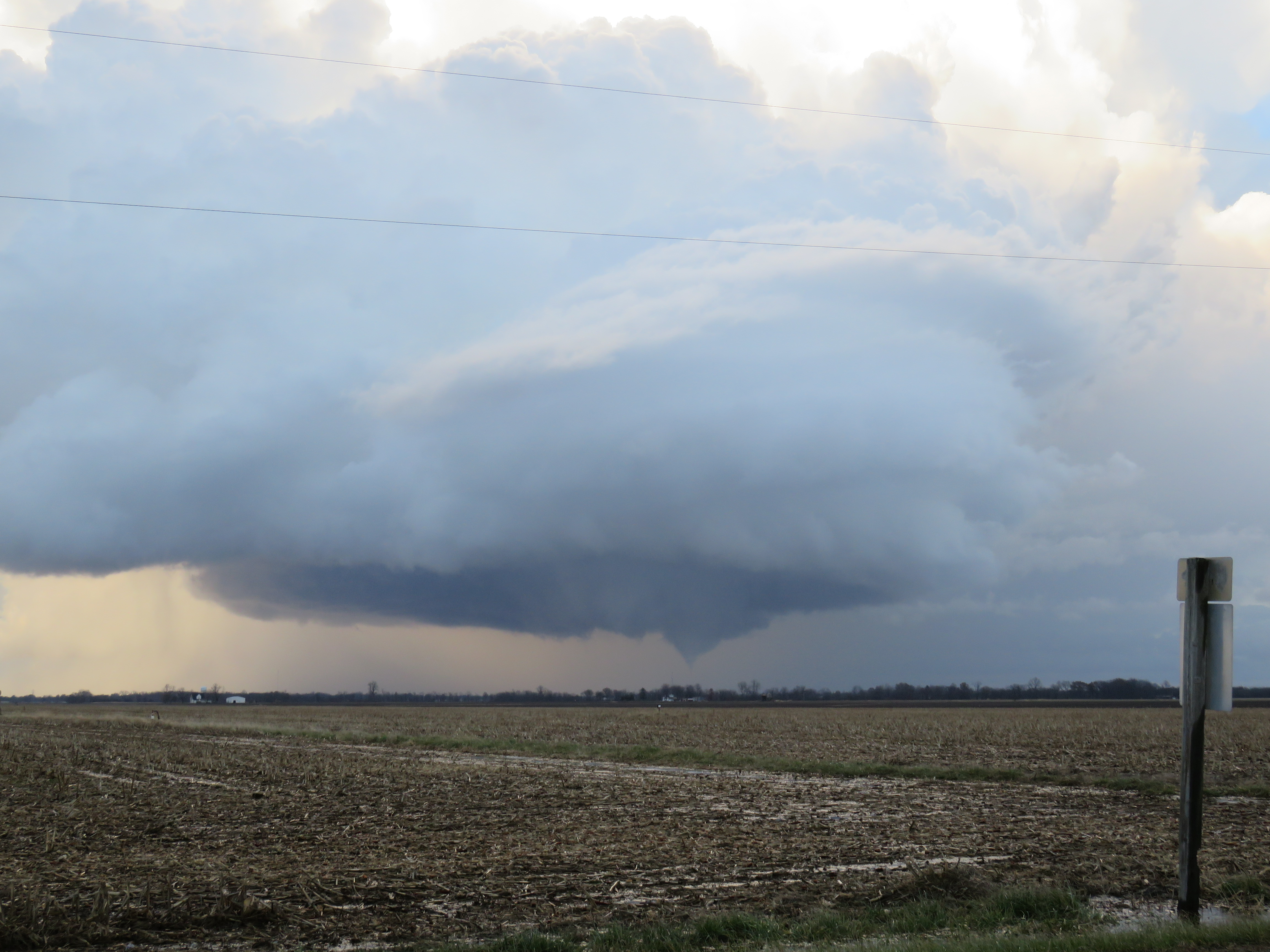
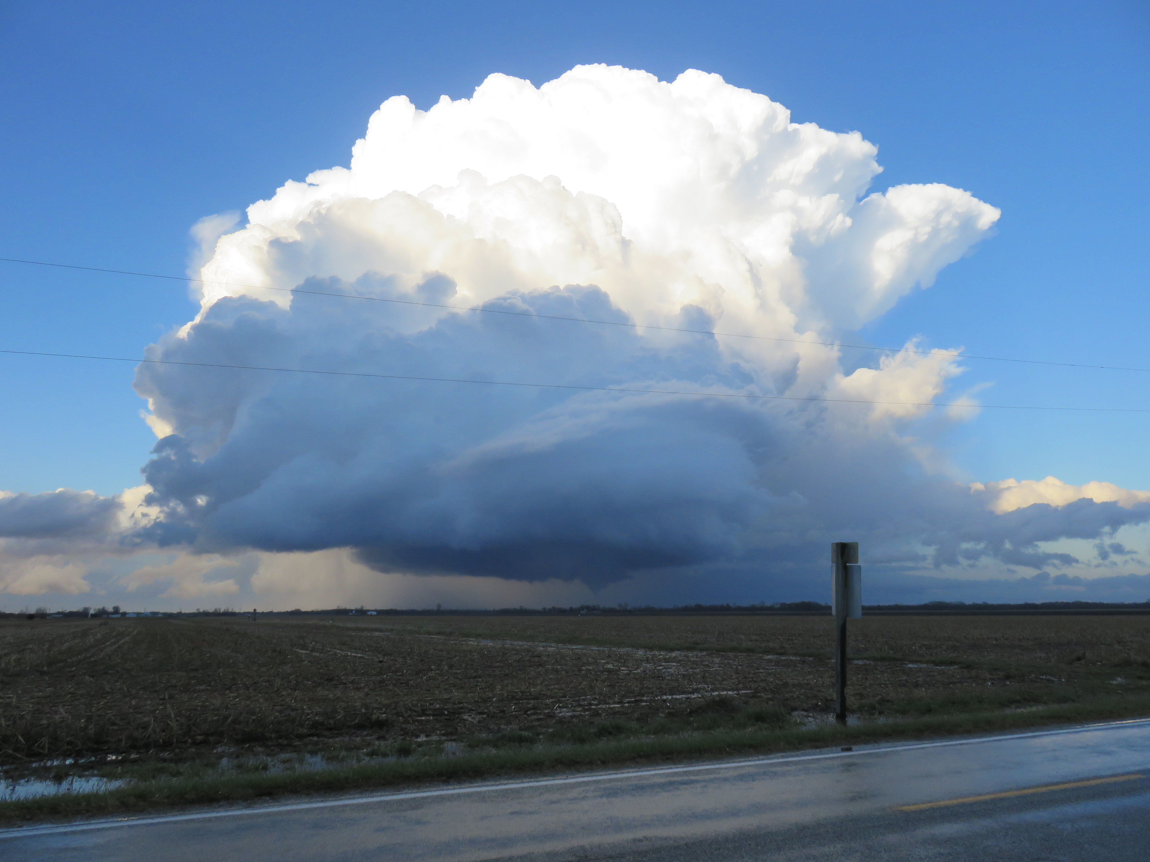
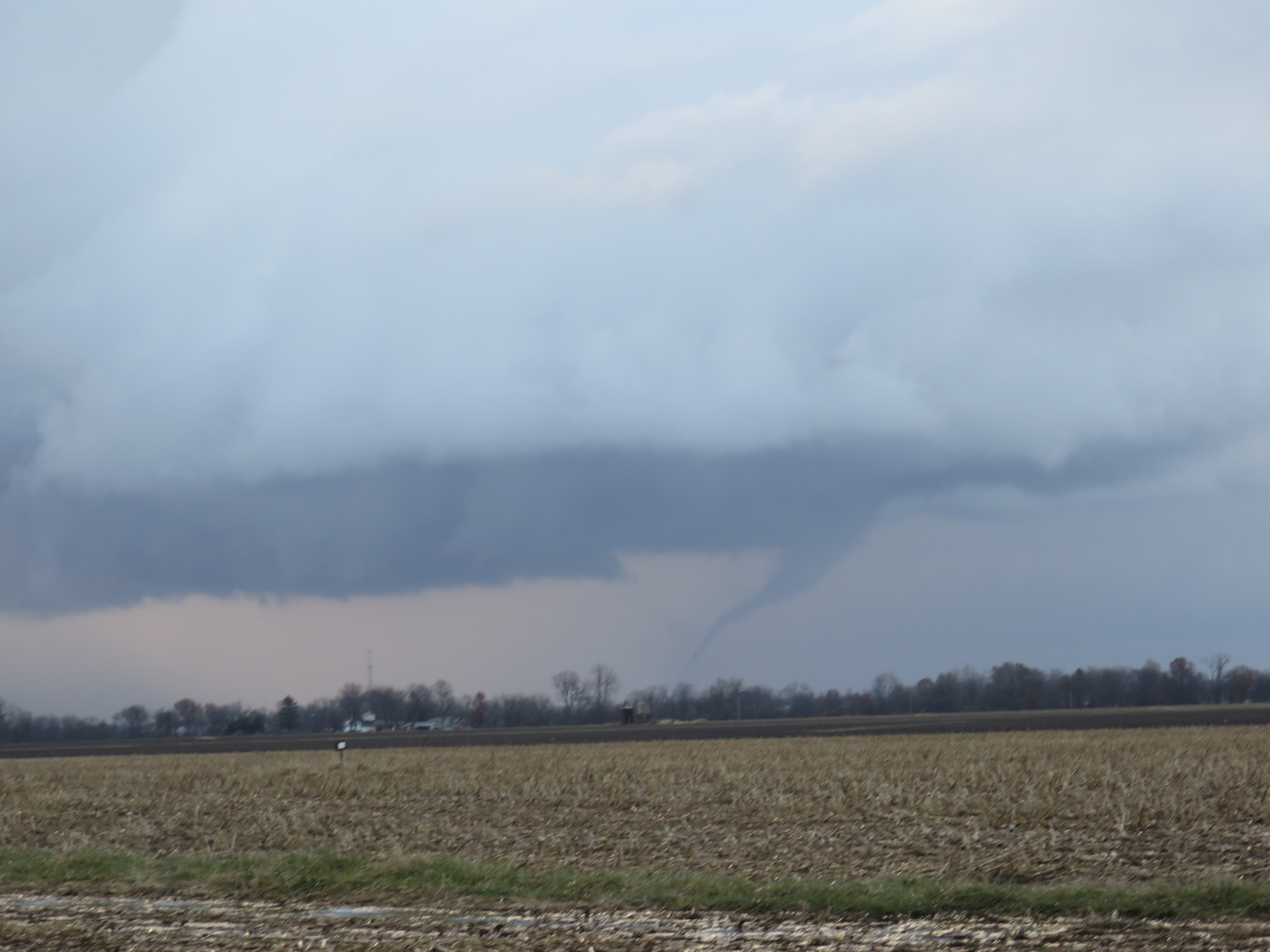
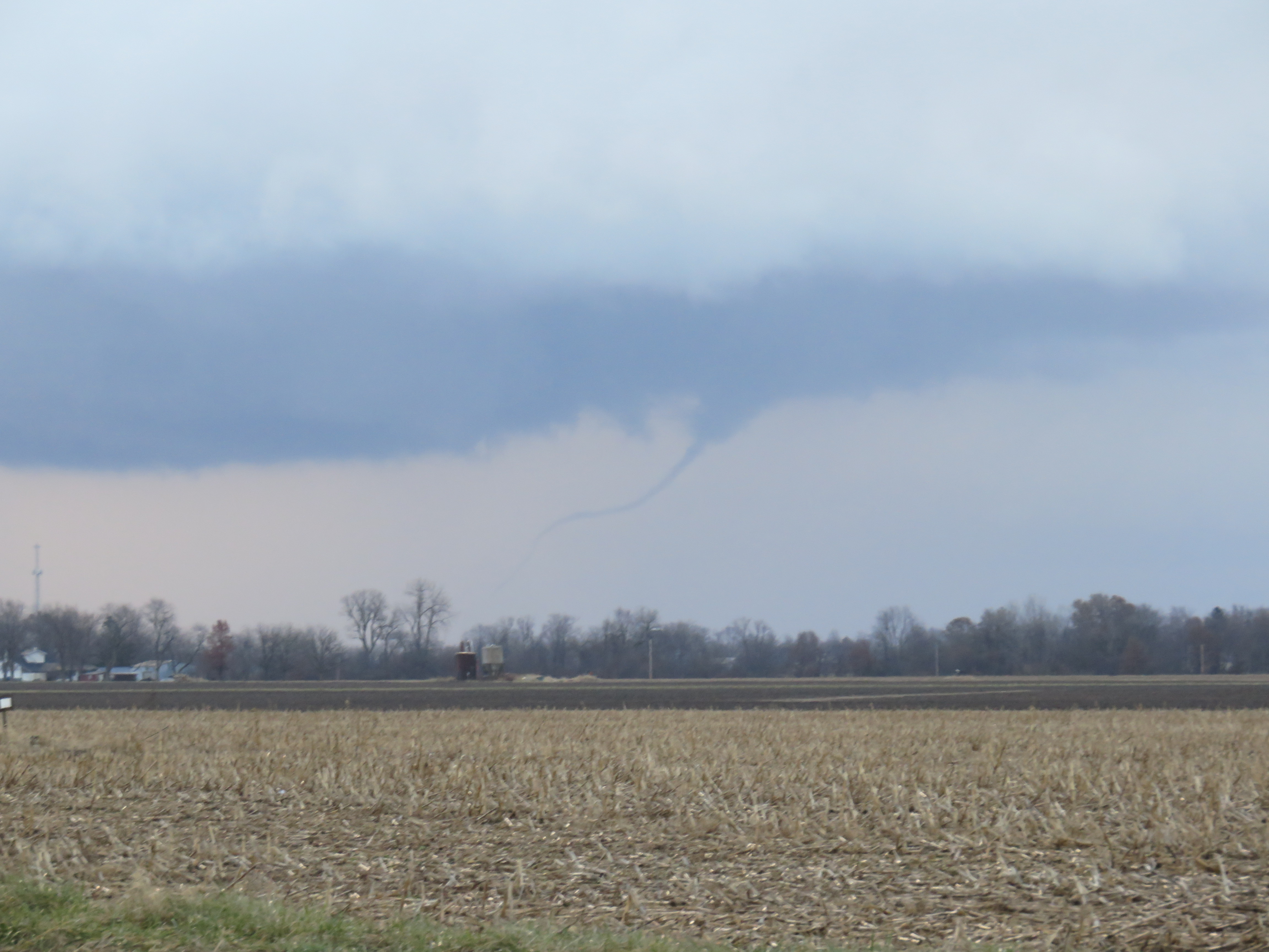
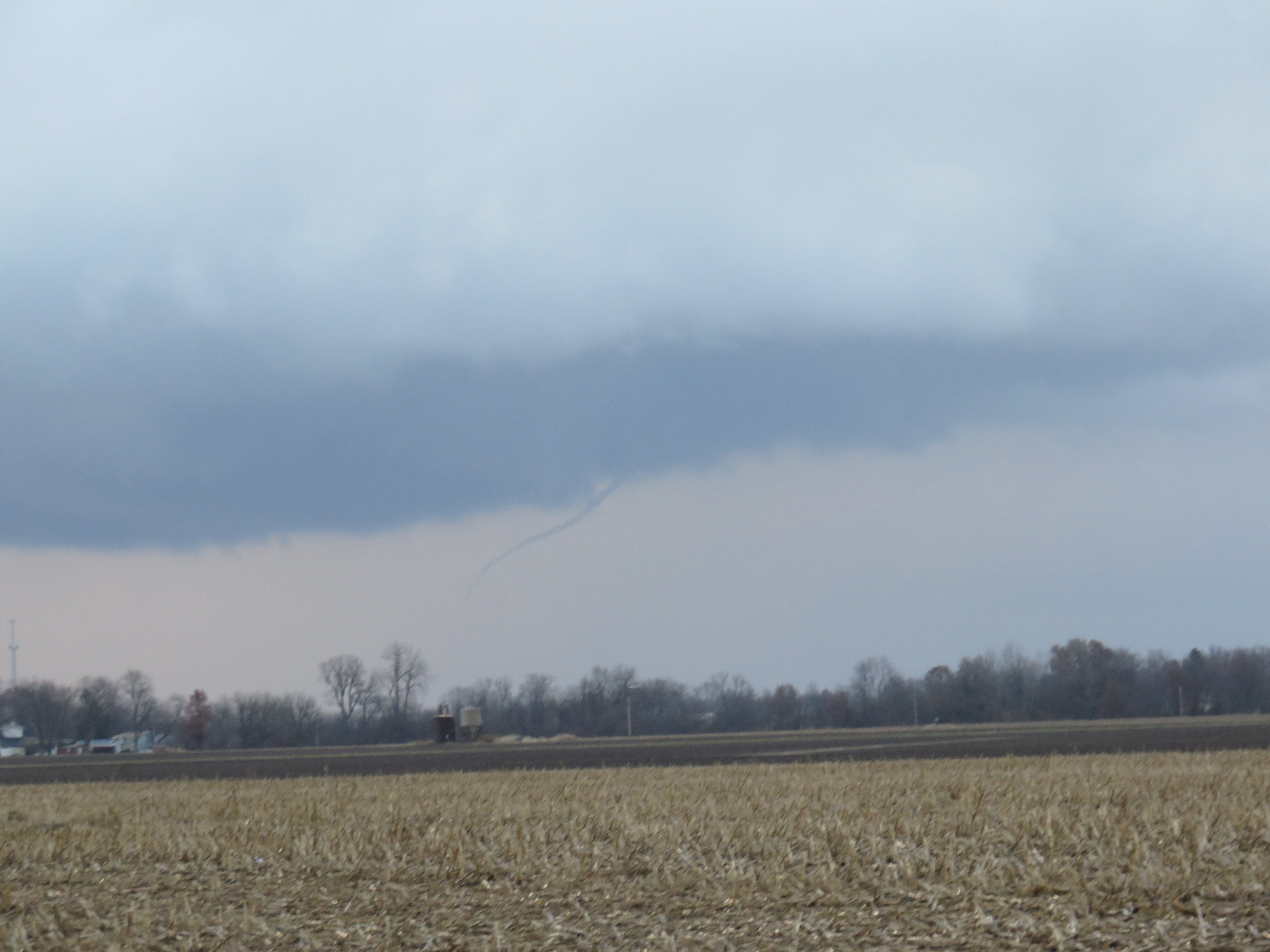
We continued south on US-83 and then headed east on Farm to Market Road 765, where we had a good vantage point of the storm to our north. The storm drifted fairly slowly to the northeast with several storm mergers between about 3:00 and 4:00 p.m., giving us a fairly long window to watch the storm with minimal repositioning to the east along FM 765. This was probably the most enjoyable part of the chase. We were ahead of and out of the rain associated with the cell to our west over San Angelo while at the same time maintaining a “decent” view of the storm to our north. At the same time, the road network really prevented us from getting a close view of the storm. The storm was roughly paralleling or just to the north of the border between Concho and McCulloch counties to the south and Coleman county to the north, right along the Colorado River and O.H. Ivie Lake. There were very few road options for crossing the river to get a closer look, and no road options that would allow us to parallel the storm on the north side of the river.

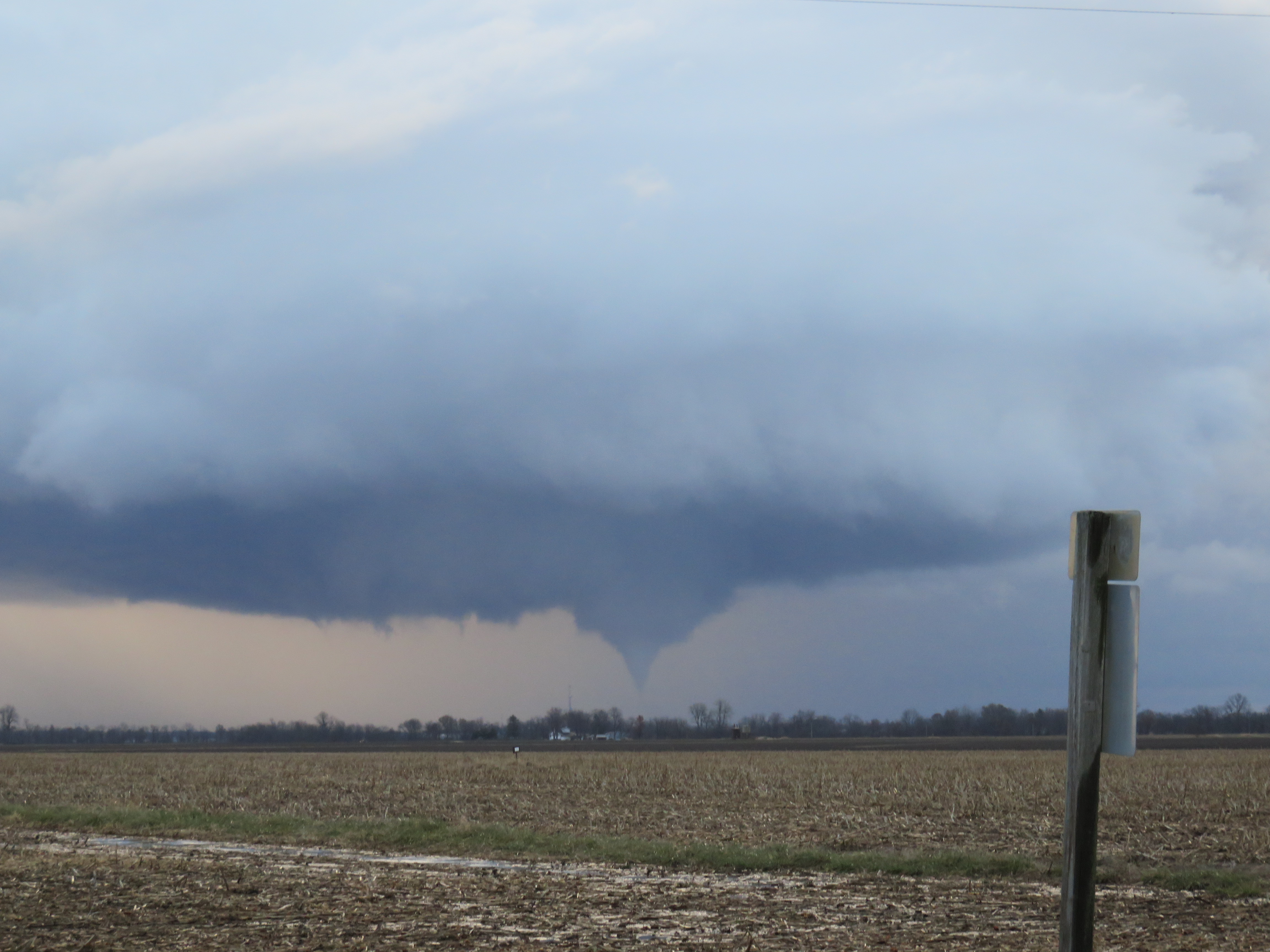
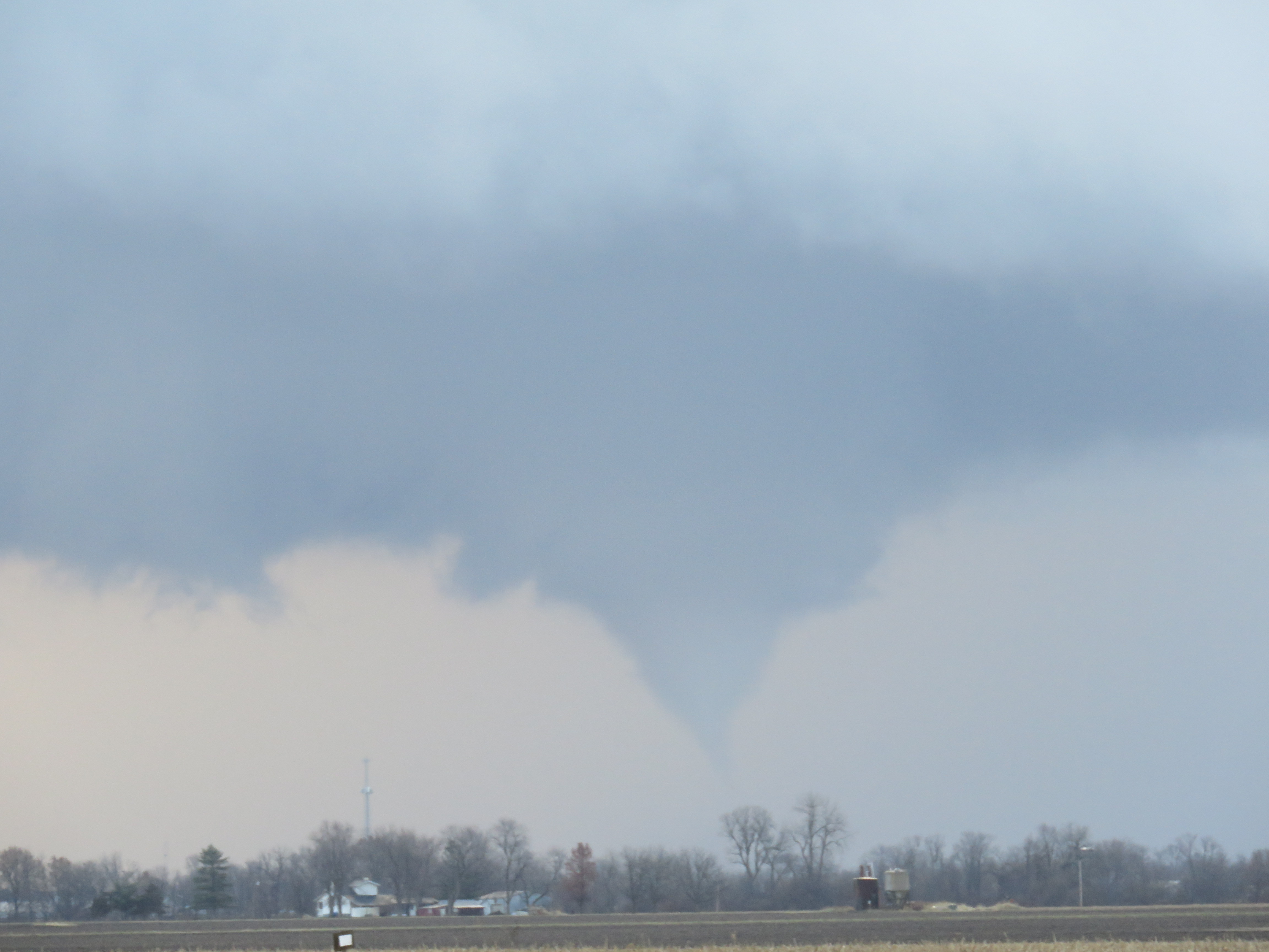
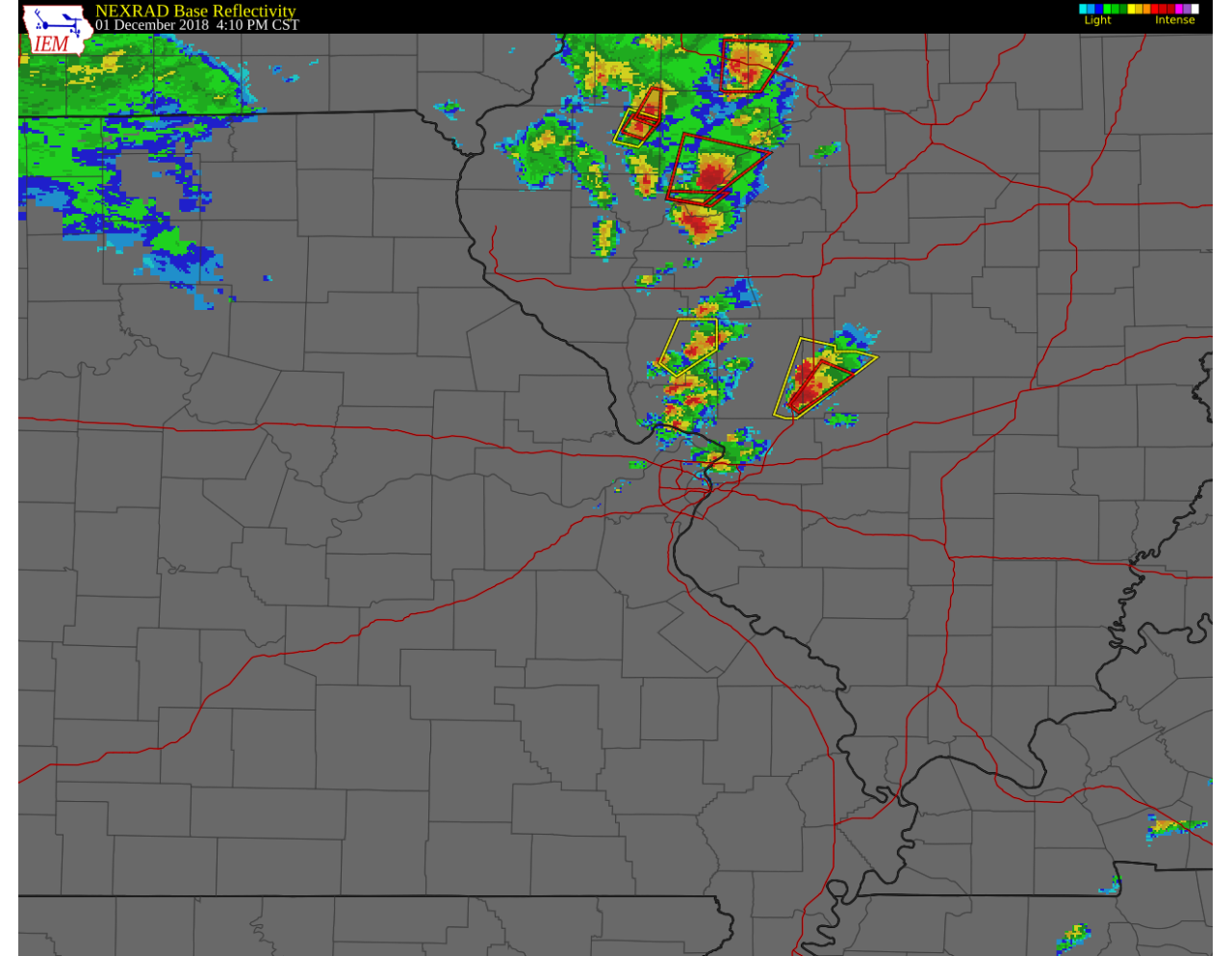
A severe thunderstorm warning was issued around 3:45 p.m. for the storm with a continued northeast motion. Over time the storm either latched onto one of the existing boundaries or developed a strong enough mesocylone to give it a more easterly component of motion. A couple other storm mergers occurred before the storm started moving east more rapidly around 4:30. We noted this and decided to approach the storm from the south, crossing the Colorado River on U.S. 283 where we again stopped to view the storm. At about the same time, a tornado warning was issued for the storm around 4:50 p.m.

Above: Radar image around 4:50 p.m. White X denotes our approximate location.
Panorama image of the supercell at 4:52 p.m., looking north on U.S. 283 around 2 miles south of Rockwood, TX

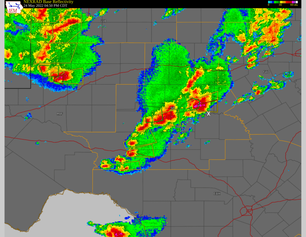
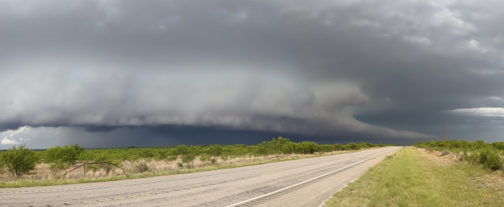
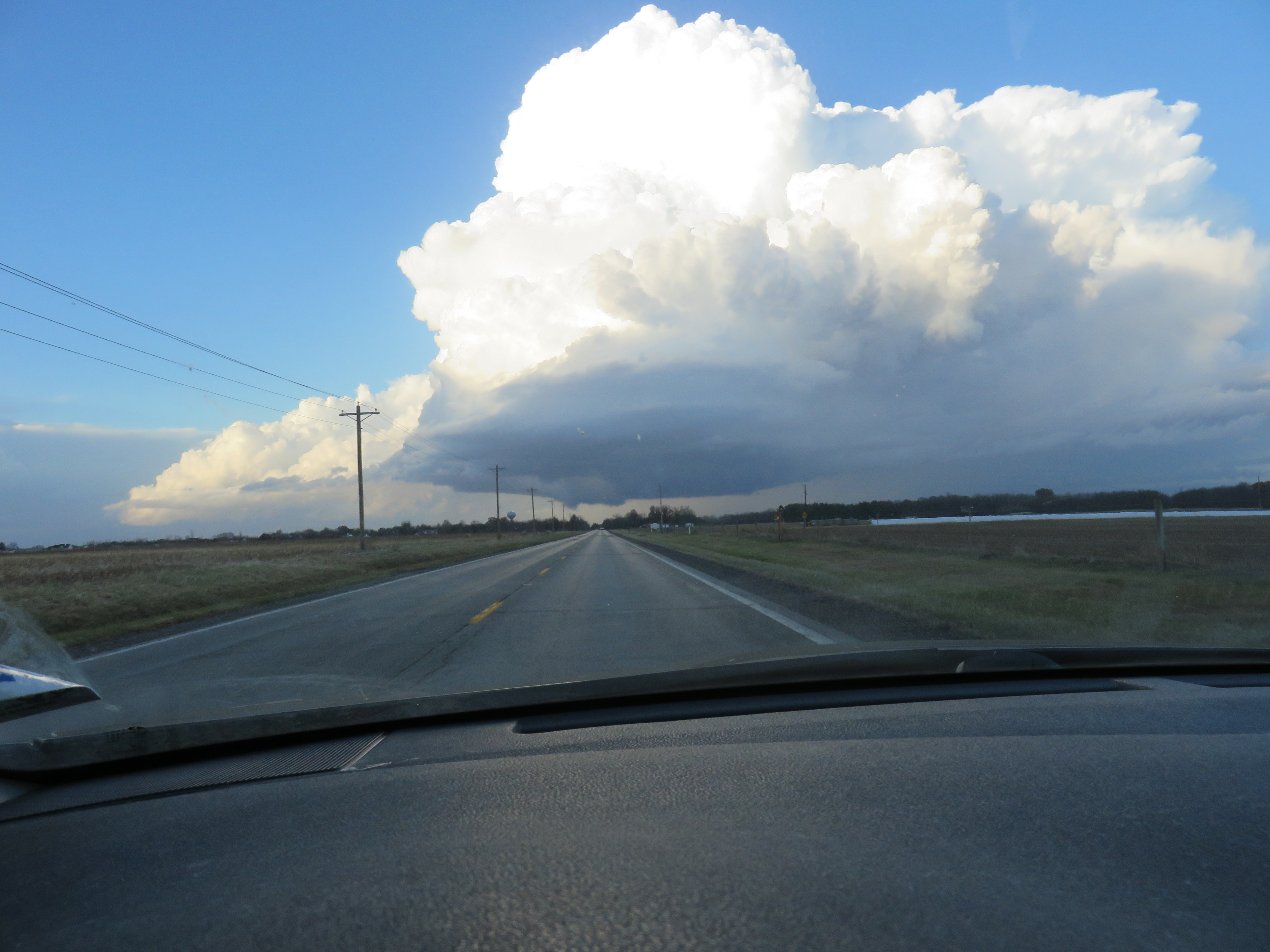
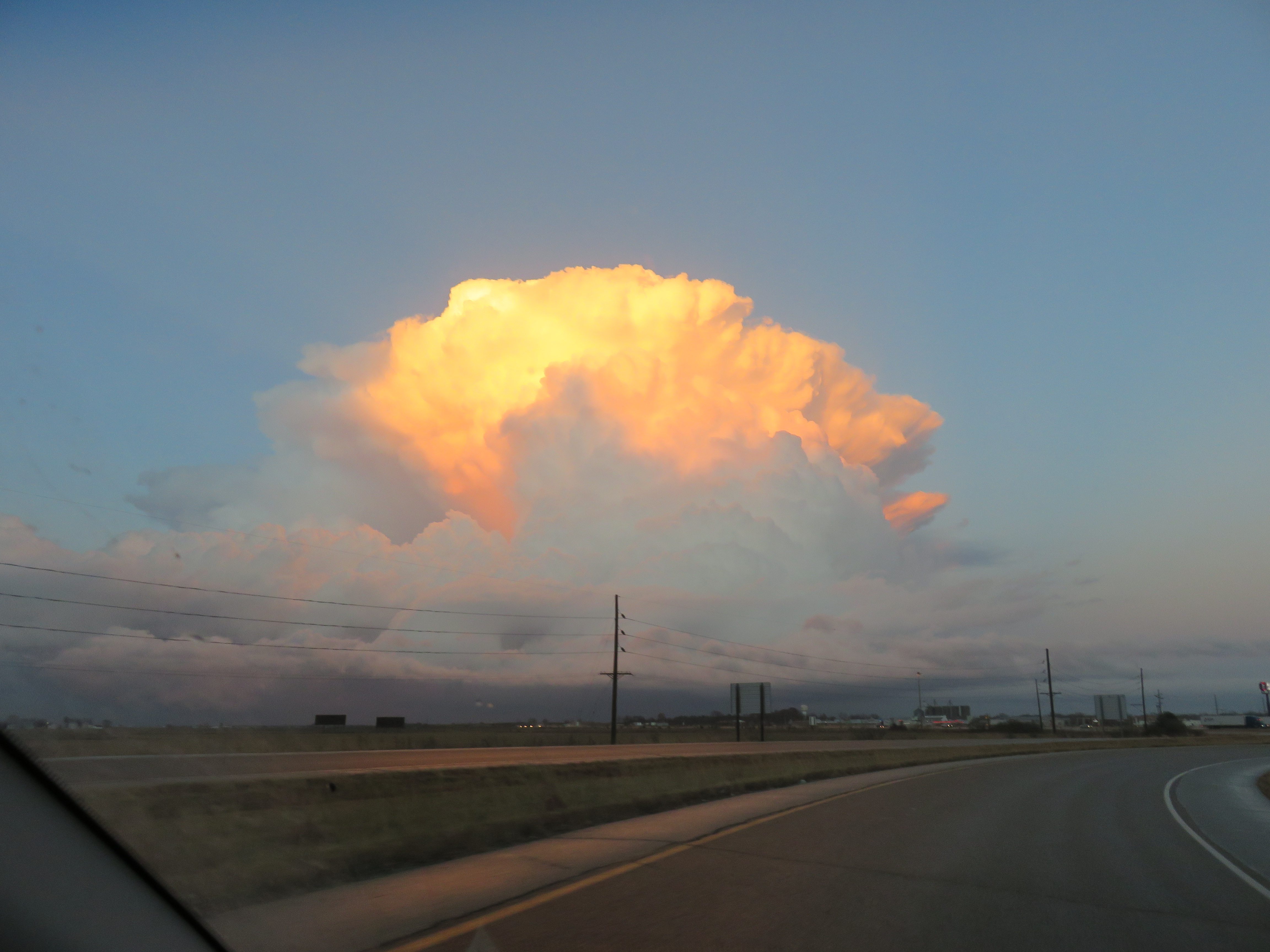
The storm was tornado warned, but if there was a tornado it was not visible from our vantage point. After watching the storm for a few minutes, we dropped back south on U.S. 283 and continued east on FM 765. At the intersection with U.S. 377, we went north because I wanted to stay ahead of the storm and get across the Colorado River. We went east again at FM 586 until it ended at FM 45 and then went north towards Brownwood. This kept us out of the rain almost all the way to Brownwood, but as we approached town and the intersection with FM 2126, the supercell caught up to us and we were caught in extremely heavy rain. We followed FM 2126 east until the intersection with U.S. 84/U.S. 183, where we were finally able to go southeast and get out of the rain. In retrospect, I think we should have continued east on FM 765 to FM 45, gone north on FM 45 to cross the Colorado River, then immediately continued east on FM 574W. This would have kept us out of the rain, out of the direct path of the storm, and possibly given us a few more opportunities to stop and view the storm. By 6:00 p.m., the various supercells began to merge into a MCS.

Above: Radar at 6:05 p.m. Our location marked with a black X as we traveled to the southeast ahead of a MCS with embedded supercells. Notice also the tornado-warned storm to the west (black arrow) – these were the storms that initiated over New Mexico and moved southeast. This tornado-warned storm did produce an EF-2 rated tornado at about this time. It’s not clear that even if we had picked that target that we would have been able to see the tornado. A video of the tornado exists and was shared with the National Weather Service but I was not able to find the video online.

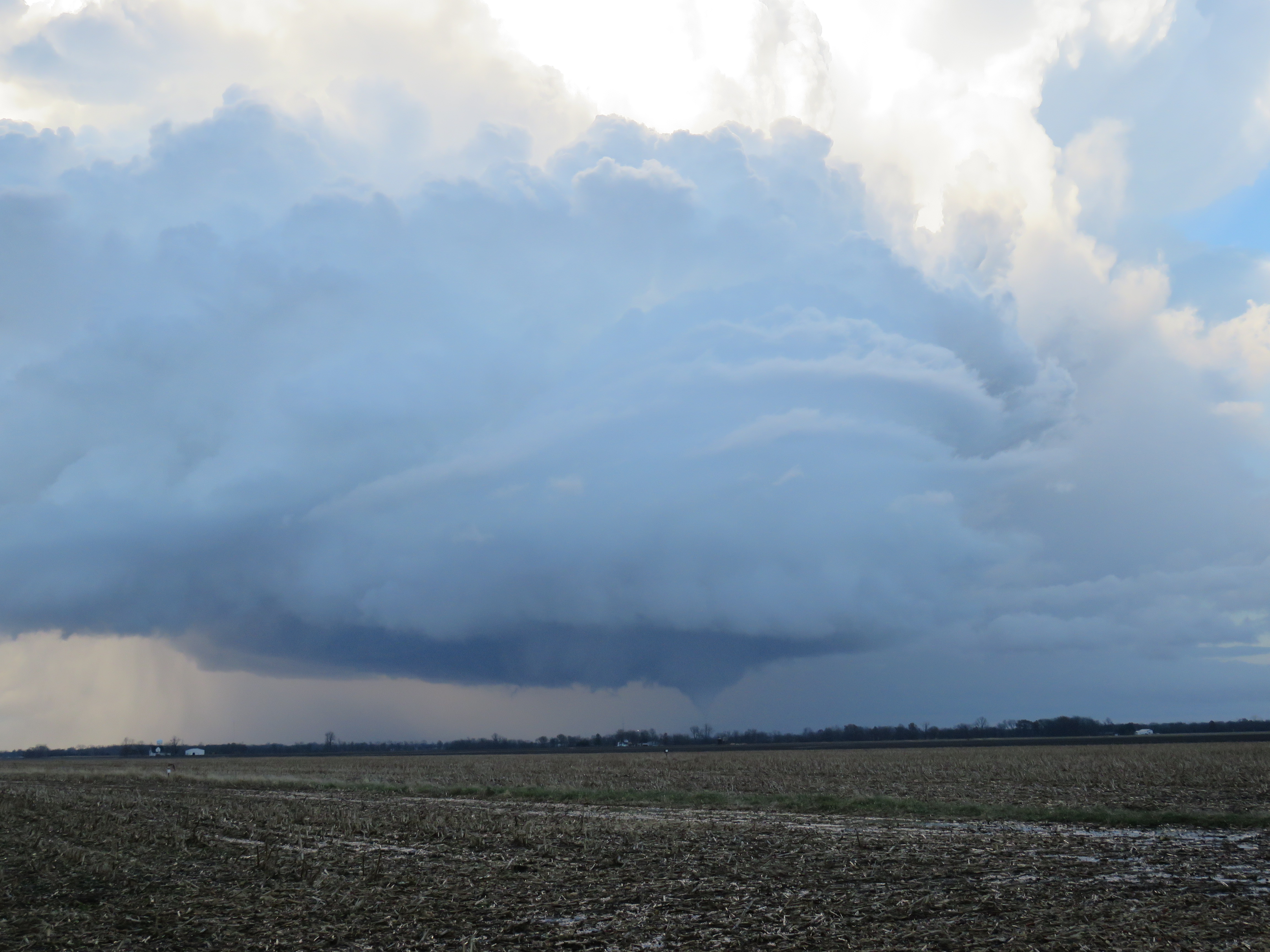
We continued southeast on U.S. 183, stopping a few times to take a look back at the storm.

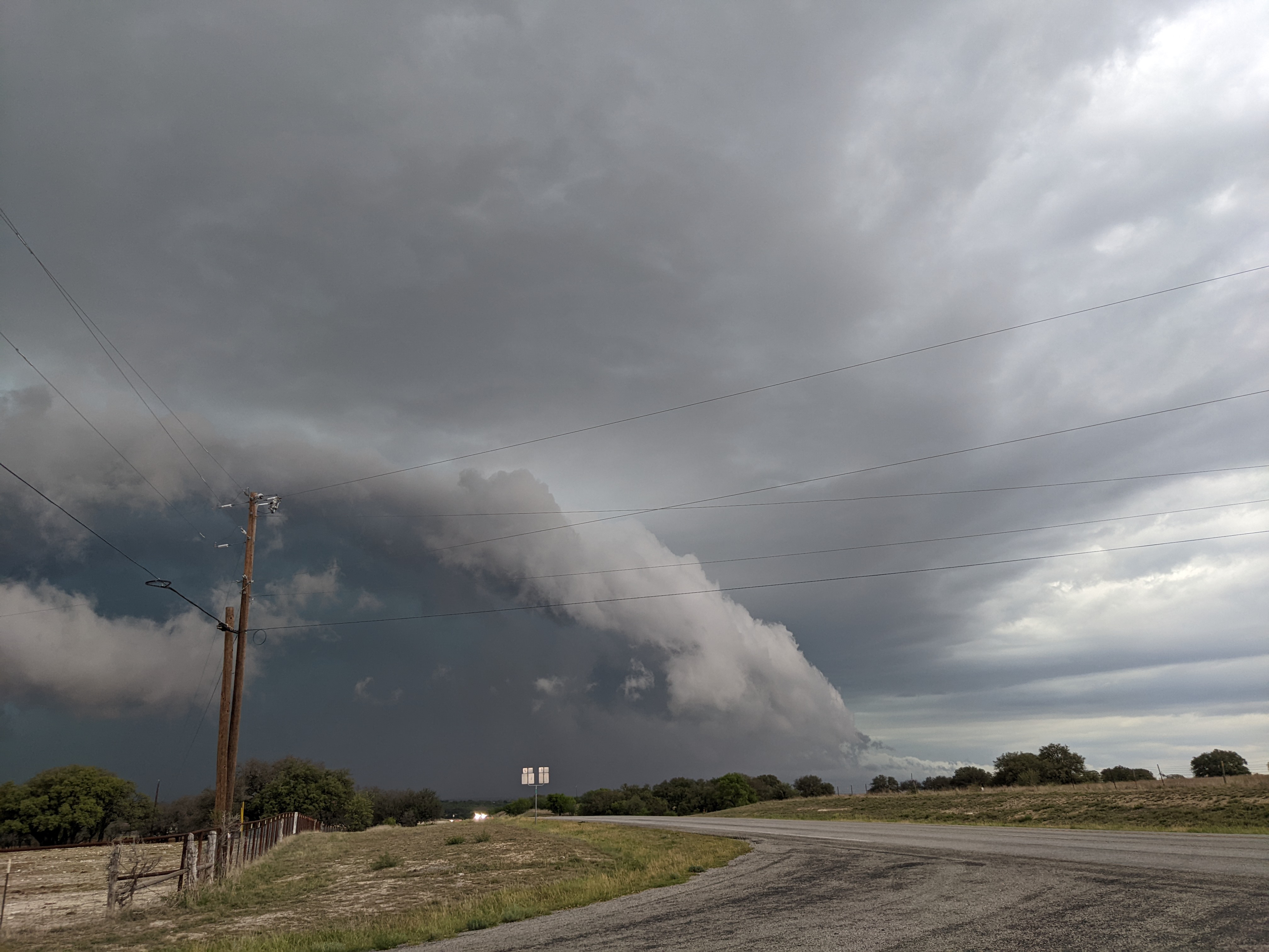
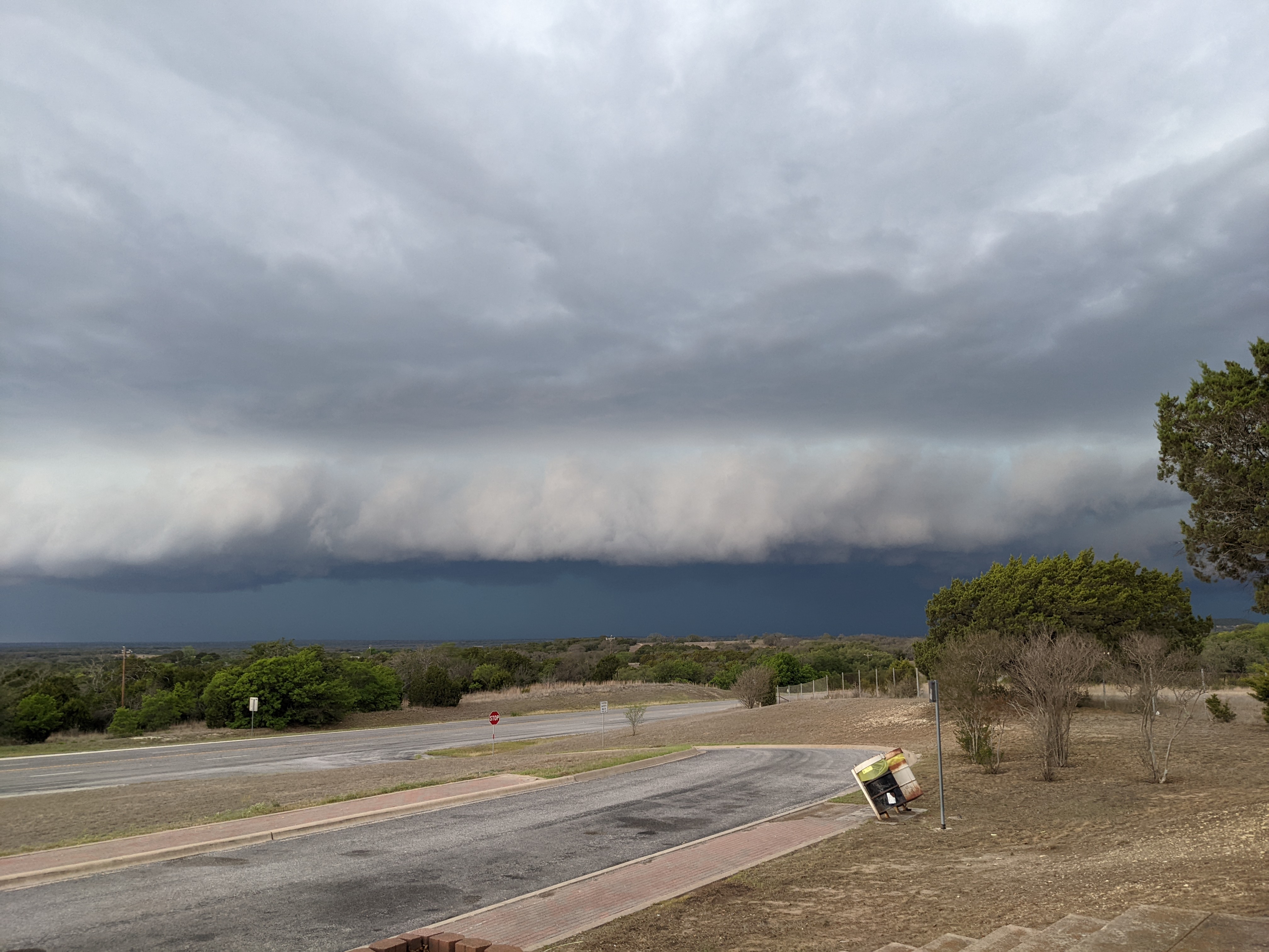
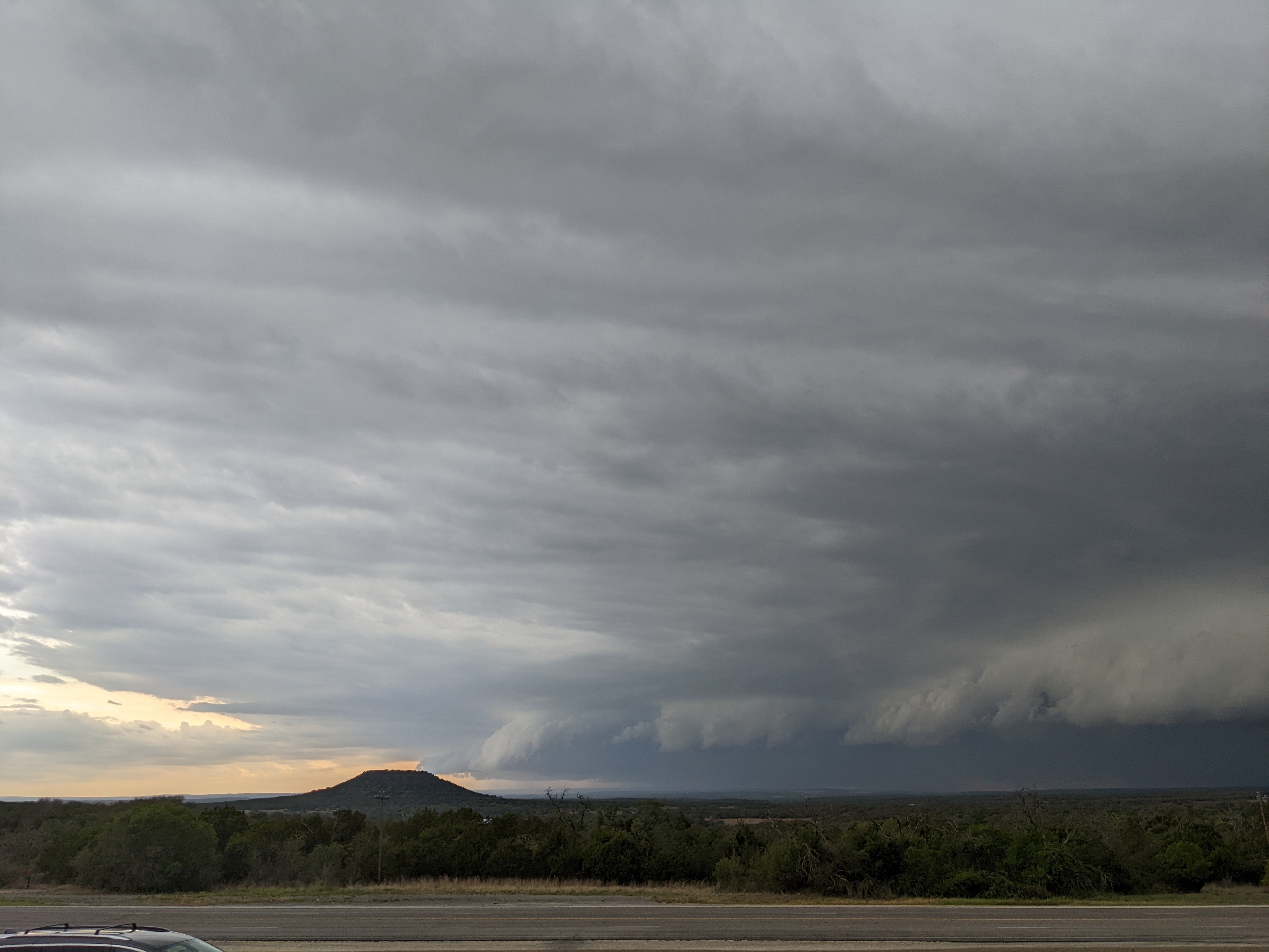
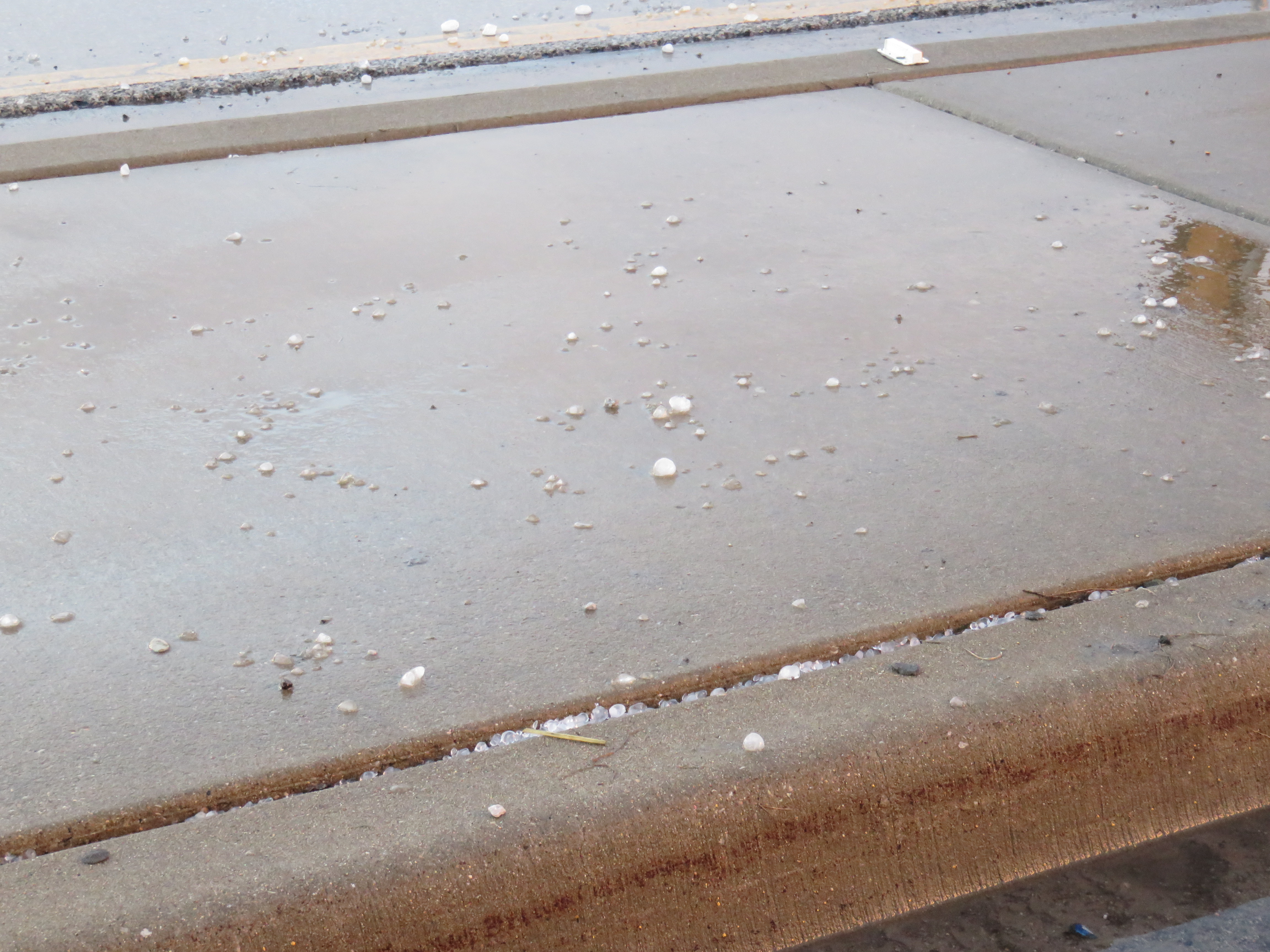
Above: Images of the shelf cloud as we retreated from the storm. Image 3 shows the storm approaching San Saba Peak in Mills County.

At this point we ended the chase and proceeded to our hotel in Temple, TX. The MCS caught up with us shortly after our arrival with torrential rain and a lot of lightning.

May 25: As expected, the cold front moved through overnight, shifting the severe weather risk to the east, from the Great Lakes through the Deep South. Any severe weather in chaseable locations was too far away for us to reach. In a bit of irony, there were a few severe weather reports in Illinois on May 25. We thought that there might be some severe weather chances to the east of the upper low across northern Illinois the following day (May 26) which we may have been able to reach but there was not a lot of appetite among the group to spend 10 to 12 hours in the van on the 25th to put us in a position to maybe intercept something on the 26th. We took a down day to do some Texas activities – eat BBQ, visit some historical sites, etc., and drifted northeast toward home, staying overnight in Mt. Pleasant, TX.

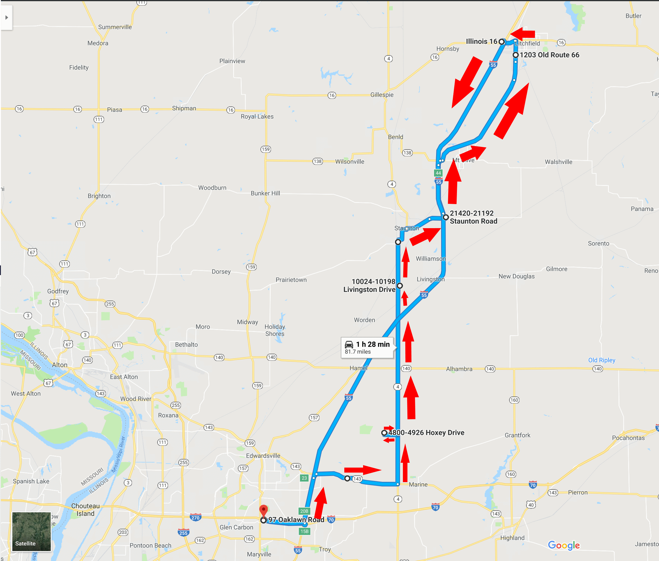
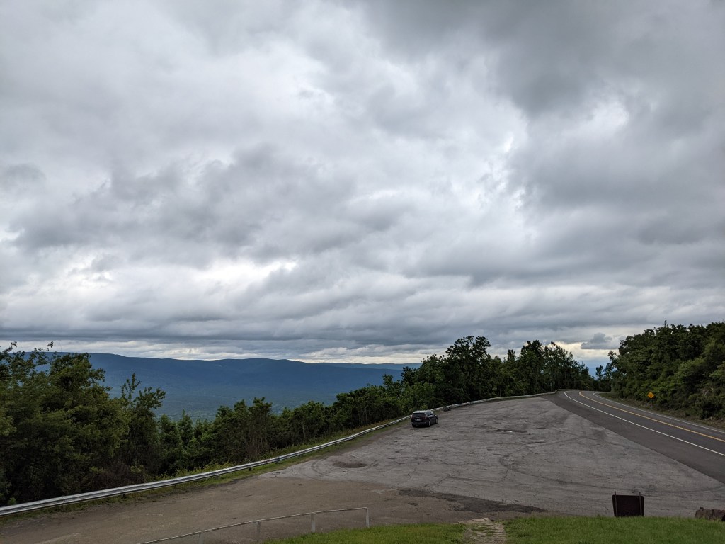
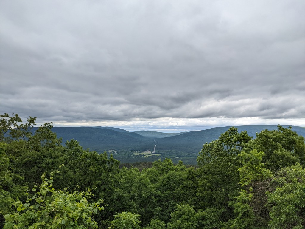
May 26: Essentially a travel day. We took the route less traveled from Mt. Pleasant through the Ozarks of Oklahoma and Arkansas, staying overnight in Springfield, MO. We stopped to snap some pictures in the cold under overcast skies. These below are from Three Sticks Monument.

May 27: We made the relatively short drive from Springfield, MO to Edwardsville to end the trip.

Final Mileage: A relatively low-mileage chase. I don’t have the exact values but around 2,200 miles.

Other Thoughts: Don’t forget something warm (jacket, etc.) when chasing! I needed it on the first day in the rain and again on May 26.

Southern IL Storm Chase – Dec. 1, 2018

A late-season severe weather event resulted in several tornadoes across central and southwestern Illinois on December 1, 2018. A total of 29 tornadoes occurred, making it the largest December outbreak of tornadoes since 1957. The strongest, an EF-3, struck Taylorville in central Illinois. At least 22 injuries were reported in Taylorville but thankfully there were no fatalities.

Meteorological Summary

An excellent and more detailed meteorological summary of the event can be found from the National Weather Service Lincoln, IL page on the event. Surface weather analyses in the early to mid-afternoon showed a low over Kansas, associated with an upper level low. An occluded front extended from the surface low toward St. Louis, with a warm front advancing northward across Illinois. South of the warm front, a generally south to southeast wind had brought an unseasonably warm and moist airmass to the region.

Surface weather map for 3:00 pm on December 1, 2018.
Surface Weather Map for 21z (3:00 pm CST) on December 1, showing the surface low in approximately the same location as the upper-level low.
Upper level map for December 1, 2018.
500 mb map at 12z (6:00 am CST), showing the low over Kansas.

The Storm Prediction Center noted that strong to severe thunderstorms could develop by midday in the region to the south of the warm front and east of the cold/occluded front. Instability was expected to develop due to cooling of temperatures aloft, advection of the previously mentioned warm/moist airmass, and by solar heating. In addition, strong speed and directional shear was expected to be present. Given this, much of western and southwestern Illinois was included in a slight risk and 5% tornado probability area on the Day 1 Convective Outlook.

20181201 1300 UTC Day 1 Outlook Graphic
20181201 1300 UTC Day 1 Tornado Probabilities Graphic
Day 1 Categorical Convective Outlook (top) and Probabilistic Tornado Graphic for 1300 UTC (7:00 am CST), December 1, 2018

HRRR model runs had also picked up on the potential for thunderstorms, consistently showing thunderstorms erupting just to the east/northeast of St. Louis by 3:00-4:00 pm CST.

Forecast Composite Radar Reflectivity for 4:00 pm December 1, 2018 as depicted by the 20z HRRR model run.

My feeling was that the best chance for severe weather and tornadoes would be further to the north in the vicinity of the warm front, but I didn’t want to travel that far…and I couldn’t shake the fact that the HRRR kept firing thunderstorms right in Madison County. By 1:00 pm, storms did begin to fire along the Interstate 72 corridor from Quincy, IL to Springfield, IL. By 2:15 pm, a tornado watch was issued encompassing most of west-central Illinois.

Tornado Watch issued at 2:15 pm for areas just to my north.

By 3:00 pm, several storms were tornado warned across the watch area, while a modest shower was just beginning to pop up, dropping a few minutes of light rain at my house.

Radar at 3:10 pm, showing several tornado-warned storms across the tornado watch area, and a rain shower over Madison County.

After watching the storm on radar for a few more minutes, I decided it was worth it to chase it and have a look. I left around 3:20 pm and proceeded to I-55 northbound to intercept. As I headed north, it was apparent the storm was going to cross I-55 near Hamel, IL and I did not want to drive directly into it on the interstate. I decided to take the exit for IL-143, go east until I could get on IL-4 north, and catch up with the storm.

Radar at 3:35 pm, with the arrow pointing to the storm sitting approximately over Hamel, IL along I-55.

Turning from IL-143 east to IL-4 north, I started looking for a suitable place to pull off and observe the storm. I ended up turning left onto Fruit Rd., going around 3/4 of a mile west before turning north on Hoxey Dr. where I had a reasonable view of the storm. I observed the very picturesque storm to my north with some obvious rotation from that location for around 10 minutes. It may have produced a brief funnel cloud which lasted around a minute.

The (approximate) route so far…
My initial view of the storm from Hoxey Dr. at 3:43 pm.
Perhaps a brief funnel? Picture taken around 3:47 pm.

The storm was moving northeast, although not at a very rapid pace (around 30 mph). At the same time, the presentation on radar looked much better. Looking at it now, it seems there were two thunderstorm cells that remained in close proximity to each other through much of their lifecycle, before the southern storm became dominant over the course of 1.5 to 2 hours.

Radar at 3:50 pm. Note the two areas of high reflectivity, indicating perhaps two cells in close proximity to each other. The southern cell would eventually become dominant and at this point is beginning to have the appearance of a hook echo.

At around 3:50, I ventured back east to IL-4 to continue north. Almost immediately, the visual presentation of the storm improved, as evidenced by the photo below, shot along IL-4 approximately 1 mile south of IL-140 at 3:55 pm. A couple minutes later at 3:57 pm, a Severe Thunderstorm Warning was issued for the storm.

Picture looking north at the storm around 3:55 pm. An obvious lowering is present at this point.

I continued north along IL-4 for another 6 miles, crossing I-55. At this point, it looked as if the storm would produce a tornado at any moment, if it wasn’t already. I turned right onto Livingston Rd., approximately 2 miles north of I-55 and immediately pulled into a driveway leading to the Bond Madison Water Company water tower. Looking north-northeast, I began taking pictures of the tornado although the funnel was not fully condensed at that point. My first picture was snapped at 4:02 pm.

My first picture of the tornado at 4:02 pm. This is a somewhat deceptive picture – the funnel was not fully condensed but some sort of tower in the foreground makes it appear that it is.
Zoomed out view of the storm at 4:02 pm.
Zoomed in; 4:02 pm.
4:02 pm
Probably my favorite picture of the storm and tornado; 4:02 pm
4:03 pm
Very zoomed in; 4:03 pm.
4:03 pm.
Beginning to rope out at 4:05 pm.
Very long rope at this point; 4:06 pm.
4:07 pm
Radar at 3:55 pm.
Radar at 4:00 pm.
Radar at 4:05 pm
Radar at 4:10 pm

By 4:07 pm the tornado had lifted. At 4:08 pm, a tornado warning was issued for the storm, including southeastern Macoupin and west-central Montgomery County. After watching the tornado, I made the mistake of continuing north on IL-4, which brought me into the middle of Staunton, IL. It took what seemed like forever to get through Staunton and I should have turned back south on IL-4 and continued north on I-55 instead. After making it back to I-55, I exited at Mt. Olive and followed the storm on Old Route 66 from there to Litchfield, IL. I caught a brief glance of a tornado to the northeast but had no real opportunity to pull off or catch up with the storm. Arriving in Litchfield, I noted some small hail that had fallen a few minutes earlier. I decided to end the chase at this point and head back home via I-55 south and I-270 west, capturing one last shot of the storm illuminated by the setting sun. Overall, it was a very satisfying chase, especially considering it was successful and on December 1st to boot! The round trip was just over 80 miles.

Hail in Litchfield, IL., approximately dime to nickel sized. Picture taken 4:37 pm.
One last shot of the storm illuminated by the sunset at 4:40 pm.
Route of the chase, with travel direction indicated by the red arrows. Return trip was via I-55 south and I-270 west, only one arrow shown.